 |
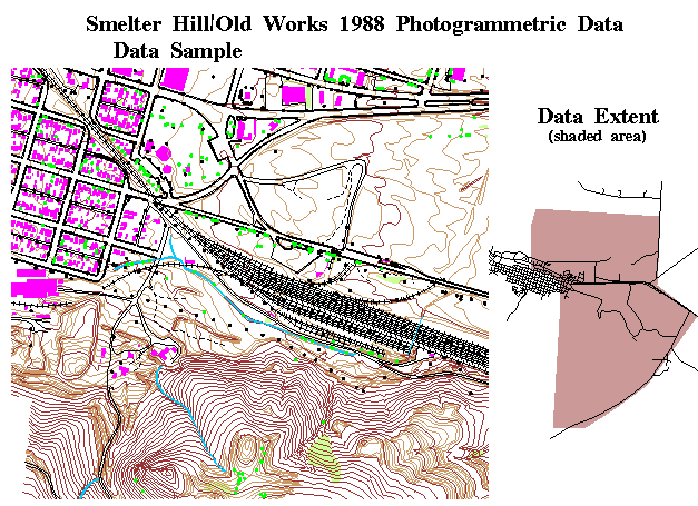
 For DEQ, the Geographic Information System
(GIS) program operates the Clark Fork Superfund GFor DEQ,
the Geographic Information System (GIS) program
operates the Clark Fork Superfund Geographic
Information System. The system, in place since
1988, provides mapping, spatial data management,
and analytical capabilities to support the
remediation of the upper Clark Fork Superfund
sites. Traditionally, maps have been the
primary product of the system. During FY 95 over
2,700 maps were composed, and printed. For DEQ, the Geographic Information System
(GIS) program operates the Clark Fork Superfund GFor DEQ,
the Geographic Information System (GIS) program
operates the Clark Fork Superfund Geographic
Information System. The system, in place since
1988, provides mapping, spatial data management,
and analytical capabilities to support the
remediation of the upper Clark Fork Superfund
sites. Traditionally, maps have been the
primary product of the system. During FY 95 over
2,700 maps were composed, and printed. |
| The Natural Heritage Program has
worked extensively with the Montana Department of
Environmental Quality (DEQ) in its mine permitting,
monitoring and reclamation efforts. This assistance has
greatly facilitated the review process for new mines and
provided a credible basis for monitoring operating mines
and reclamation efforts. |
An oil company requested
information on groundwater in north central Montana. The
company planned to inject oil well wastewater into the
ground and needed to verify that no potable water sources
would be affected. For reclamation efforts, this is
important information. |
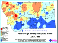 |
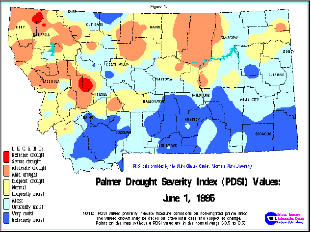
The Water Information System coordinates the
Drought Monitoring Program, a special effort to track
snow pack, precipitation, surface water, and soil
moisture conditions statewide. Drought monitoring maps
and charts are critical decision-making tools for the
Governor's Drought Advisory Committee, and for citizens
as they plan for and respond to recurring drought
conditions in our state. |
| The Montana Natural Heritage
Program (NHP) has provided in-depth assessments for
highway projects to Montana Department of Transportation
(MDT) planners. This information and assistance has
allowed MDT to identify conflicts and sensitive areas
early in the highway planning process, thereby avoiding
expensive delays and litigation. |
For the Abandoned Mine Bureau at
DEQ, the NRIS GIS staff developed programs and procedures
to automate the development of 230 mining district maps.
Hard copy and electronic versions of the maps were
delivered to DEQ. |
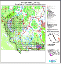 |
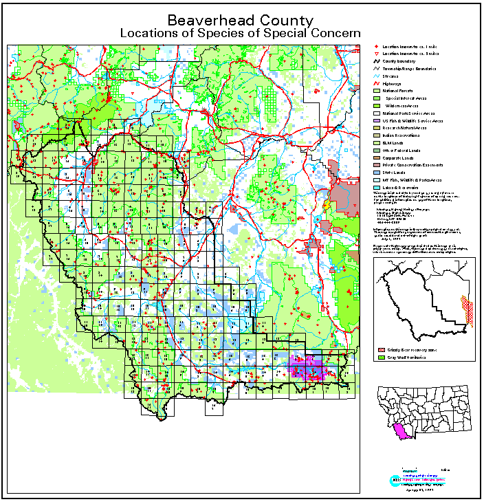
The Natural Heritage Program has worked
closely with weed districts, county planners and local
governments to provide maps of counties showing
comprehensive information on land use, sensitive species
locations and other resources. This project has been
effective at providing service to all users, especially
local governments. |
 Service
Examples
Service
Examples